A file, and a map on a wall
The record is complete and the picture is years old, so the question what does this plot look like now cannot be answered from the desk.
A housing society is too big to hold in your head and too slow to walk. The plots live in a ledger, the build stages live in somebody’s memory, and the ground itself is the one thing nobody can show you. Six drone clips across two dated visits were joined into a single 3D, fifteen buildings were measured off it, and 514 plot records were put back on the ground they belong to.
Somebody in the office opens a file. Somebody on site looks at a plot. A buyer in another country has neither and is paying monthly anyway. All three are talking about the same piece of land and none of them can see it and its record at the same time, which is why every argument about a plot starts by establishing what is actually there.
The record is complete and the picture is years old, so the question what does this plot look like now cannot be answered from the desk.
What is built is obvious to anybody standing there and invisible to everybody who is not.
Paying instalments on a plot they have never seen, and asking the one question nobody can answer with a photograph.
Every figure here came off the 3D rather than off a drawing. Each building was boxed and then checked against three separate drone frames before the number was kept, because a box that only agrees with the frame you drew it on is not a measurement.
Roof parapet about 23 m, dome about 30 m, and a minaret still in scaffold at about 54 m.
Every one boxed in the 3D and checked against three separate drone frames before the figure was kept.
The sort of thing that exists on a site plan as a rectangle and on the ground as something with a height.
Stock footage carries no position data, so the size of everything in a 3D built from it has to be established from something in the picture whose real size is known. Here that was the road: a standard lane width of 3.65 metres and a parking bay depth of 5.0 metres, read off the markings in the 3D itself. Four marks were measured and they agreed within 2.5 per cent.
That gives a working margin of about five per cent, which is tighter than the eight to twelve we quote when scale has to be guessed from how high the drone was flying. It is worth saying plainly why: it is tighter because it was read off the ground rather than estimated from the air, and it still rests on those road markings being standard ones. Where a boundary or an area has to be settled, the surveyed figure rules and this does not.
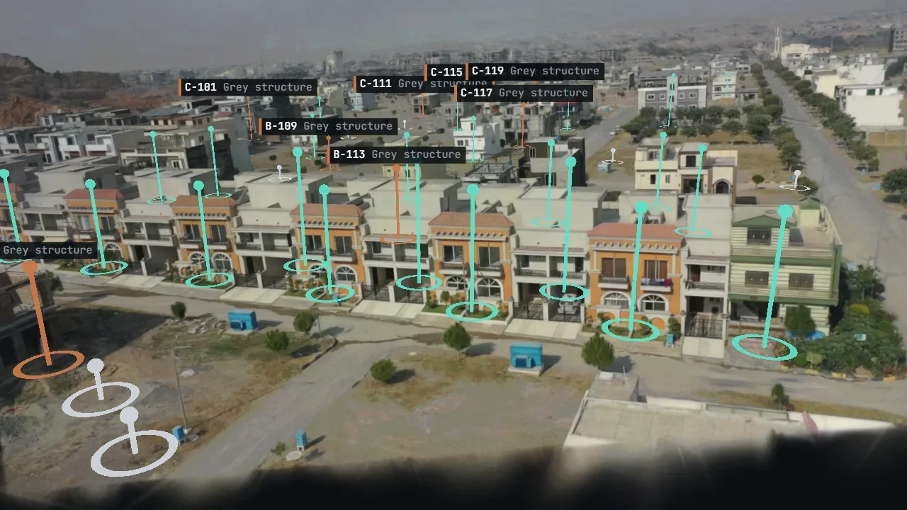
Nineteen plots carry records in this build. Thirteen are drawn around buildings that were measured; the other six are a sample layout on open ground, which is what a society looks like when it has sold land that nobody has built on yet.
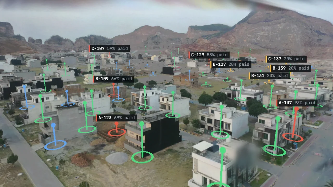
Available, booked, sold, on instalment, rented, or on the resale register, painted on the ground rather than listed beside it.
How far through the payment plan each plot is, so the question of who is behind is a colour on a map rather than a morning in a ledger.
Read by eye from the drone frames and marked on each building, so progress is shown rather than asserted.
The same 3D presented four ways, because the site engineer, the sales desk, the office and the planner are not looking for the same thing.
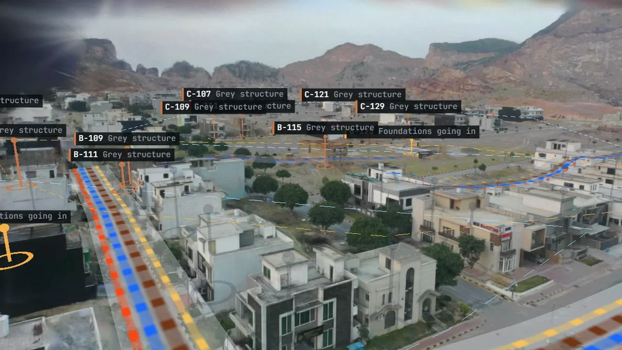
Two dated sets of clips were solved together rather than separately, so the earlier visit and the later one sit in the same 3D and the same coordinates. That is the difference between a picture of a society and a record of one: you can ask what moved between the two dates and get an answer that is not somebody’s recollection.
The two web builds the demonstration actually serves score 34.0 and 35.2 dB against frames held out of the build, the earlier visit and the later one in that order. Heavier builds of the same footage score higher, and they are not what the demo serves, so they are not quoted here.
Our own build, on licensed stock footage. No client commissioned it and the society is not named anywhere in it.
All 514 records, with their owners, files, payments, holds and rents, are invented for the demonstration and labelled as sample on every layer. The proportion of files taken is sample data too. Nothing here is anybody’s real register.
Measurements are good to about five per cent, from standard lane and parking bay sizes read in the 3D. A capture is a record rather than a survey: where a boundary, an area or a quantity has to be settled, the surveyed figure rules and nothing here replaces an inspection.
Build stages were read by eye from the footage and the trees were found by software and have not been checked. Treat both as somewhere to look rather than as a count.
One pass over the society answers it for everybody at once, and the second pass months later is what turns the answer into a record. Tell us how many plots you are holding and what your office currently answers by hand, and we will tell you what a capture would and would not settle.
Tell us where the place is, or send us a clip you already have, and we will come back with what it would take and what it would cost, in the same reply. There is nothing to pay to find out.