The record and the place live apart
The spreadsheet knows the plot number. The wall map knows where it is. Putting the two together is somebody reading a row out loud while somebody else points.
A sales office keeps who owns which plot, which file it sits in and what has been paid in a spreadsheet. The buyer sees a map on a wall. Neither of them can see the place and the record at the same time.
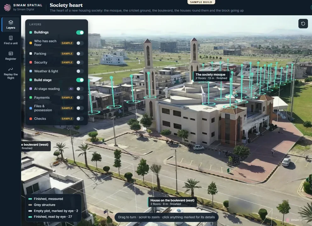
Our own build, from stock footage. The society is not named. Owners, payments and files in the picture are sample data and the panel says so on every layer.
The spreadsheet knows the plot number. The wall map knows where it is. Putting the two together is somebody reading a row out loud while somebody else points.
Build stage is whatever the last person to visit remembers, and an overseas buyer cannot visit at all.
Sales, accounts and the site team each hold a version, and the gaps between them surface at the worst moment.
One drone pass becomes a model of the society you can turn, zoom and click, in a browser, with nothing to install.
Owner, file and payment state sit on the plot itself. In this build they are sample data, labelled as such on every layer.
Each building is marked finished or not finished from what the drone actually saw, so the picture does not depend on the last site visit.
Every figure here says whether it was measured, estimated or read, because a figure without that is not usable.
The buyer sees the plot and its record together, which is the conversation the wall map was always standing in for.
A link, opened on a phone in another country.
The next pass shows what moved, so progress is shown rather than asserted.
Owners, files and payments in this build are invented to show how a society’s own register sits on the map. Your figures come from your register.
The 52 buildings are found from the footage. The 13 empty plots are a person looking, and they are reported separately for that reason.
Good enough to see what is there and what is not. Where a boundary or an area has to be settled, a surveyed figure rules.
Every project is bespoke and quoted after we understand it. You deal with the engineer who would do the work, and we reply within one working day.
No obligation, and nothing to pay to find out.