Three parties, three pictures
The operator, the insurer and the contractor each hold a different version of the same site, and the differences only surface when something has gone wrong.
They each need the same things: where the units are, how far apart they stand, what condition they are in, and what the cranes could reach. Today that lives in a site visit, a folder of photographs and somebody’s memory.
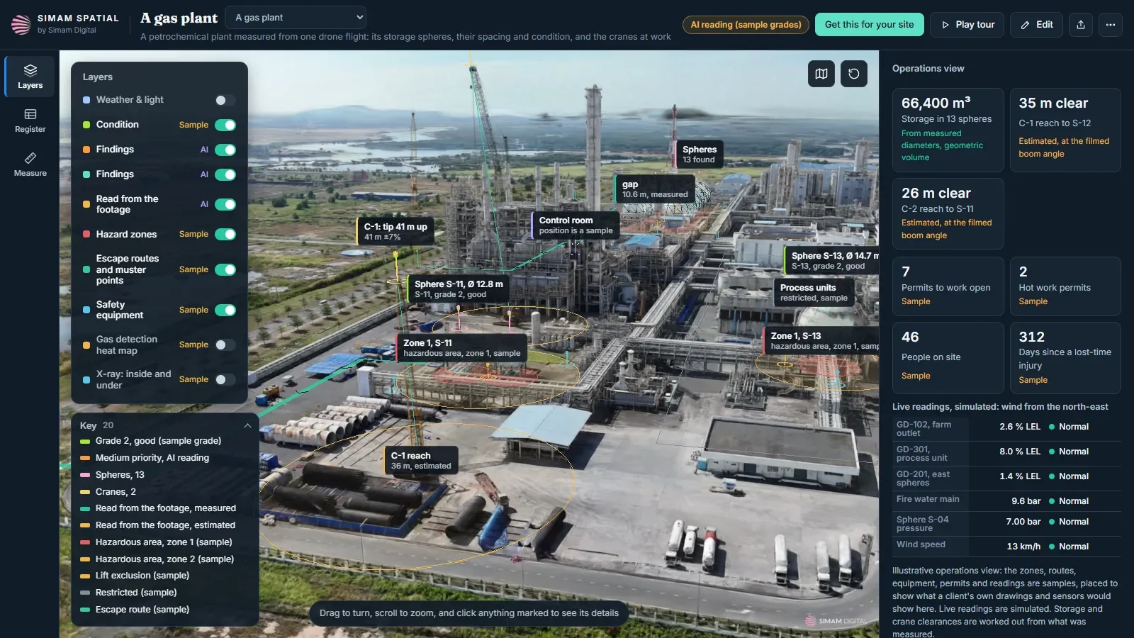
Our own build, from stock footage. The plant and its operator are not named. The operations layers are illustrative and the panel labels them.
The operator, the insurer and the contractor each hold a different version of the same site, and the differences only surface when something has gone wrong.
How far apart the vessels stand, and what a crane could reach, are the questions a site visit is booked to answer.
Nobody has time to compare two hundred images, so nobody does.
Every unit boxed and measured on the model, in a browser, with nothing to install.
The same vessel carries what it is, what condition it is in, when it is next due, and how exposed it is, so the operator, the insurer and the contractor read the same object their own way.
Hazard zones, escape routes, muster points and readings sit on the ground where they belong. In this build they are samples, and the panel says so.
Every figure here says whether it was measured, estimated or read, because a figure without that is not usable.
The operator, the insurer and the contractor open the same site on the same day instead of three versions of it.
The site walks itself through, so a room full of people sees the same thing in the same order.
Each flight adds a dated picture, so change is visible rather than described.
Zones, routes, permits and readings here are samples, placed to show what your own drawings and sensors would show. They are not a safety case.
Where the footage does not say what a building is for, the page says so rather than guessing. Your own drawings settle it in an afternoon.
The model is scaled to within about 7%. Clearances and distances are good enough to plan and talk about, and a surveyed figure rules where one exists.
Every project is bespoke and quoted after we understand it. You deal with the engineer who would do the work, and we reply within one working day.
No obligation, and nothing to pay to find out.