Pitch changes the quantity, not just the method
A sloped surface is bigger than its shadow on the ground, and the gap grows with the angle. Pricing a pitched roof off a plan area quietly under-orders.
Area, height and the pitch of every face, read off a 3D of the building rather than off a tape measure at the top of a ladder. Enough to price a job or set a reserve before anybody is sent up, and honest about which of its numbers you can lean on.
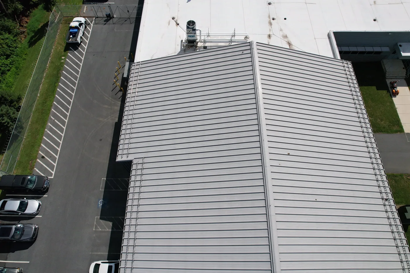
An estimator needs area, pitch and height before they can quote, and the only ways to get them are a ladder, a scaffold or a guess off satellite imagery. The first two are a visit and a risk assessment. The third gives a plan outline with no pitch and no height, which is most of what the quote turns on.
Area, pitch and height. Together they decide the materials, the access equipment and most of the labour. They are also the three things least likely to be written down anywhere, because getting them has always meant going up.
A sloped surface is bigger than its shadow on the ground, and the gap grows with the angle. Pricing a pitched roof off a plan area quietly under-orders.
Whether a job needs a tower, a scaffold or a cherry picker is settled by a figure most estimates carry as "about".
Not to one you are bidding for. The measurement everybody needs is the one before the decision, and that is the one nobody pays a surveyor for.
The roofer, the insurer, the facilities manager and whoever is costing solar all start from area, pitch and height.
No ladder, no scaffold, no access equipment and nobody on the roof to get them.
The two pitched faces came out at 14.9 and 13.5 degrees. A single rounded figure would have hidden that they differ.
Scale comes from the drone’s own positioning rather than ground control, so the figures are a guide of about three to five per cent and the page says so beside them.
Half the roof is not explained by the fitted planes and the page publishes that share, because three planes without it would imply the whole roof had been read.
All of them are decisions a person makes with a better number in front of them, and none is a survey.
Every figure on this page says what kind of figure it is. That is the whole of why it can be used.
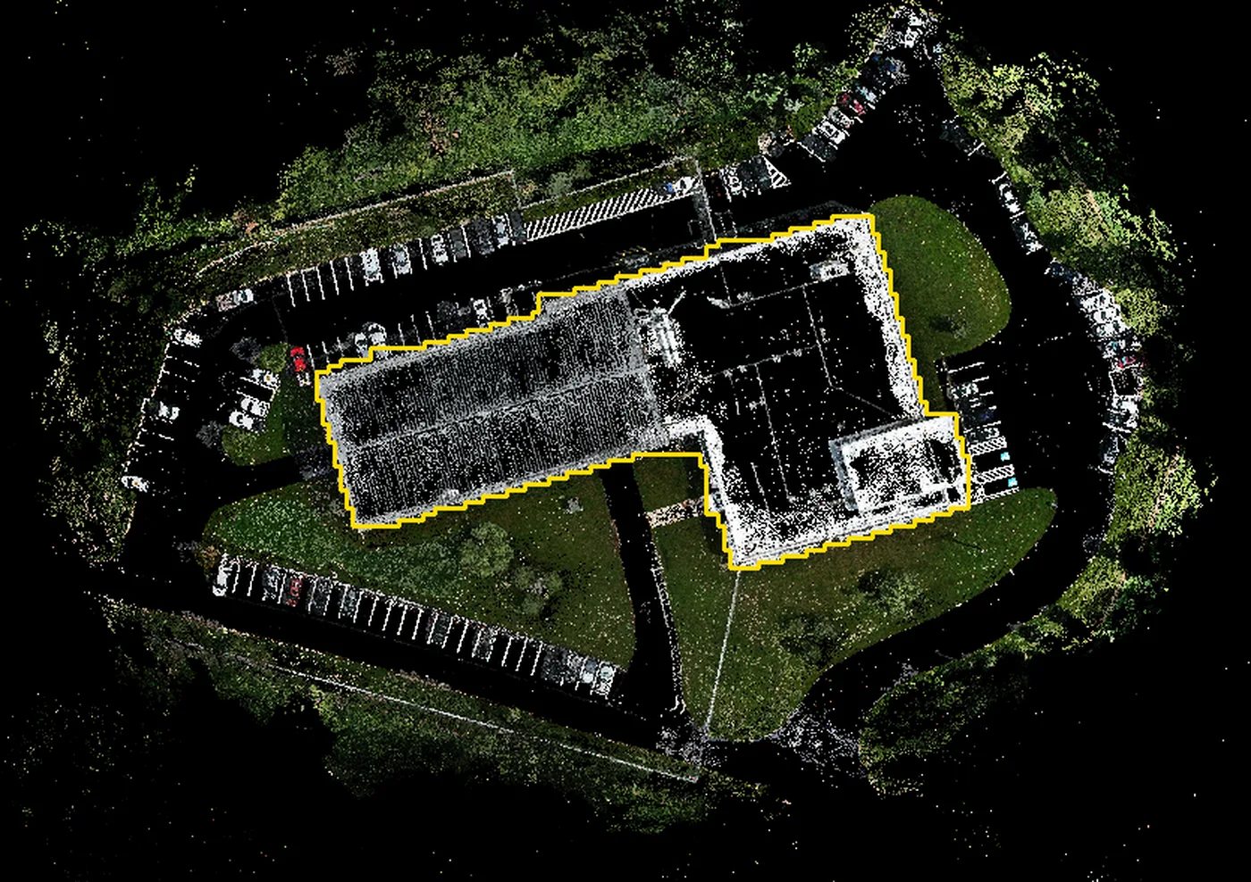
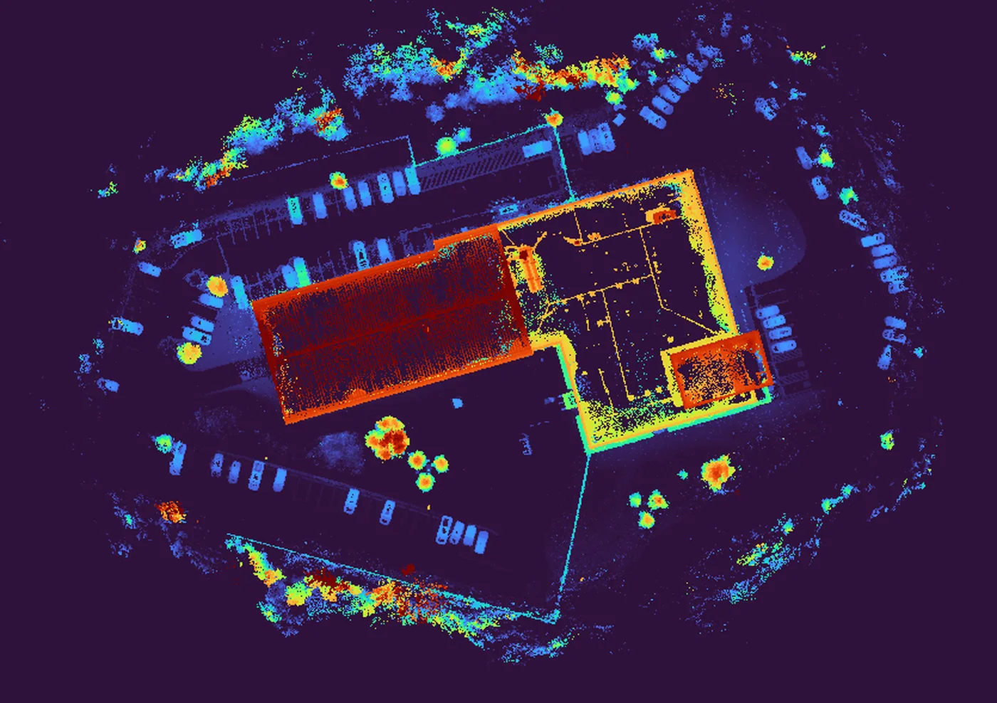
The number on this page is the roof’s shadow on the ground. The sloped surface of a pitched face is bigger, and the page gives the pitch so the conversion can be made.
No damage reading at all. The white metal renders too noisily for it and we are not going to pretend otherwise.
Three to five per cent is good enough to decide whether to quote and what access to plan for. It is not good enough to settle a boundary, a claim or a contract quantity.
Nothing here was compared against a ladder visit or a satellite estimate, so there is no figure for what it saves.

Captured by Airweb’s drone pilot network. The flying is theirs and the reading is ours. Their logo is their own, shown on a dark panel of ours so it is legible here.
No. Scale comes from the drone’s own standard positioning rather than from ground control, so every figure is a guide of about three to five per cent. Where a surveyed figure exists, the surveyed figure wins. What this replaces is a guess, not a survey.
Not directly, and this is the most important line on the page. The published area is the PLAN area, the roof’s shadow on the ground. The real surface of a pitched face is larger: divide by the cosine of the pitch, which at about fifteen degrees adds roughly three and a half per cent. We did not do that conversion on this job, so we are giving you the plan area and the pitch to do it with rather than a number that looks finished and is not.
The part of the roof that did not fit any of the three planes: plant, upstands, raised sections, and areas the flight did not resolve cleanly enough to call. It is on the page because leaving it off would make three planes look like a whole roof.
No. The white metal roof renders noisily in the 3D, so reading damage off it would be guesswork, and we would rather say that than sell a condition report nobody should act on. For damage, look at the photographs closely. That is a different job and we would scope it as one.
RTK, or ground markers. Either takes the scale from metres to centimetres and the figures from a guide to something an engineer can lean on. Neither was used here.
The first attempt at finding ground level picked a lawn rather than the hard standing, which put the roof height out, and it was redone. Everything on this page is from the second pass.
We do not know and we will not put a figure on it. Nothing on this job was compared against a ladder visit or a satellite estimate, so there is no saving to quote and we are not inventing one.
One routine crosshatch flight over the building, flown by pilots who already fly them. No access equipment and nobody on the roof. If you already hold suitable footage we will look at that first.
Tell us what the building is and what you need to know about it. We will say whether this would answer it, including when it would not.