“Which one is mine?”
A unit number on a price list means nothing until it is the room you are standing in, at the height you will actually be at.
A client commissioned a marketing demonstration: could a residential tower be rebuilt in 3D from ordinary drone footage, and every home in it opened up on its own floor, on its own side of the building, with its view and its price? Seven clips in. A browser you can orbit, filter and export from, out. It runs on a phone with nothing to install.
Homes in a tower are sold from plans, a price list and a render of the outside. None of those answers the question the buyer is actually asking, which is what this particular home, on this floor, on this side, will be like to stand in and look out of. A plan cannot show a view. A render of the lobby cannot show the ninth floor facing the mountains.
A unit number on a price list means nothing until it is the room you are standing in, at the height you will actually be at.
The view is most of what separates two identical apartments, and it is the one thing a floor plan cannot carry.
Availability lives in a spreadsheet that the thing the buyer is looking at knows nothing about.
The tower and the blocks around it were reconstructed from drone footage flown near and far, then measured from that reconstruction and opened up as sample residences. Each one sits on its real floor and its real side of the building, carries its size, whether it faces the mountains or the city, its status and its price, and the whole register can be filtered and exported.
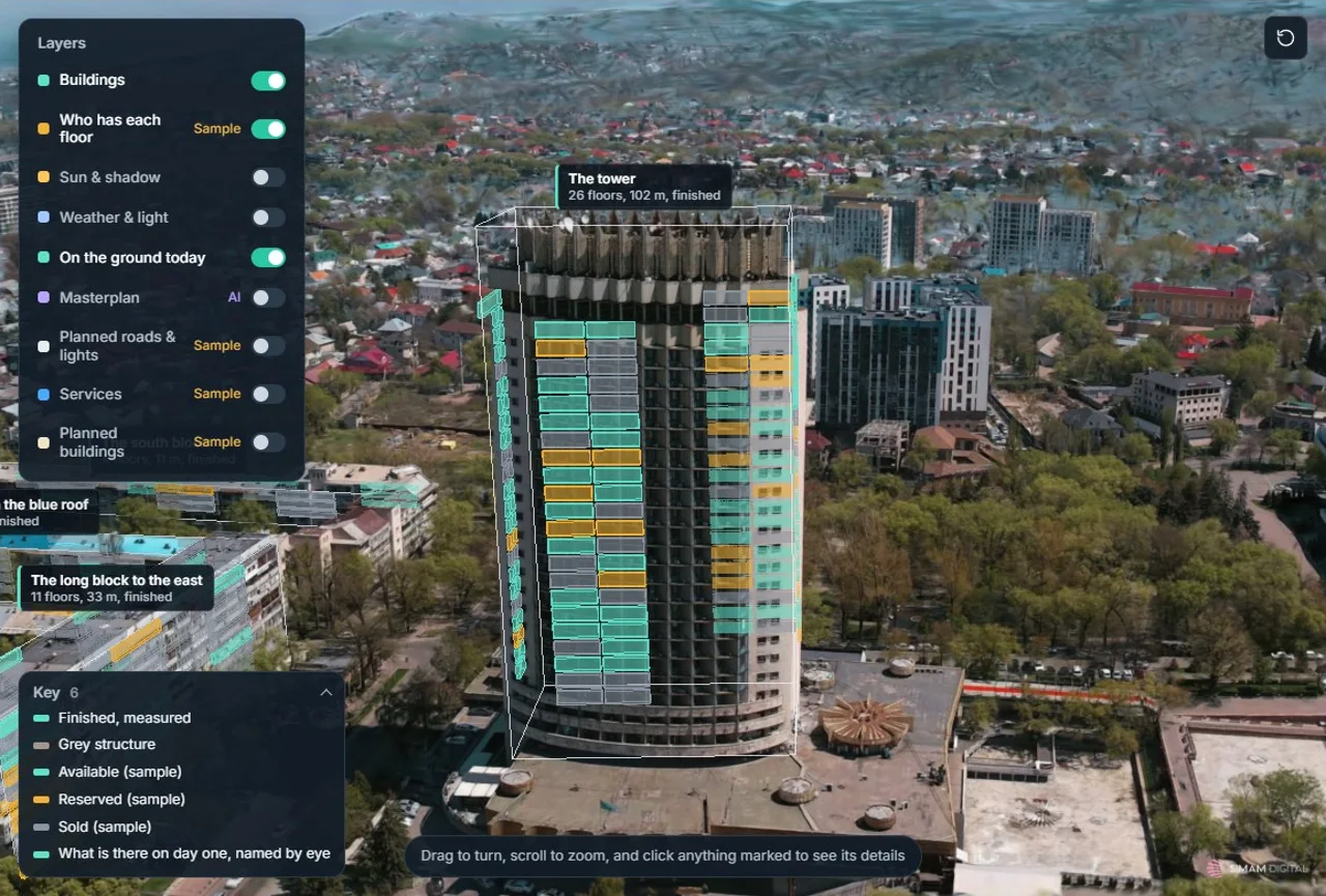
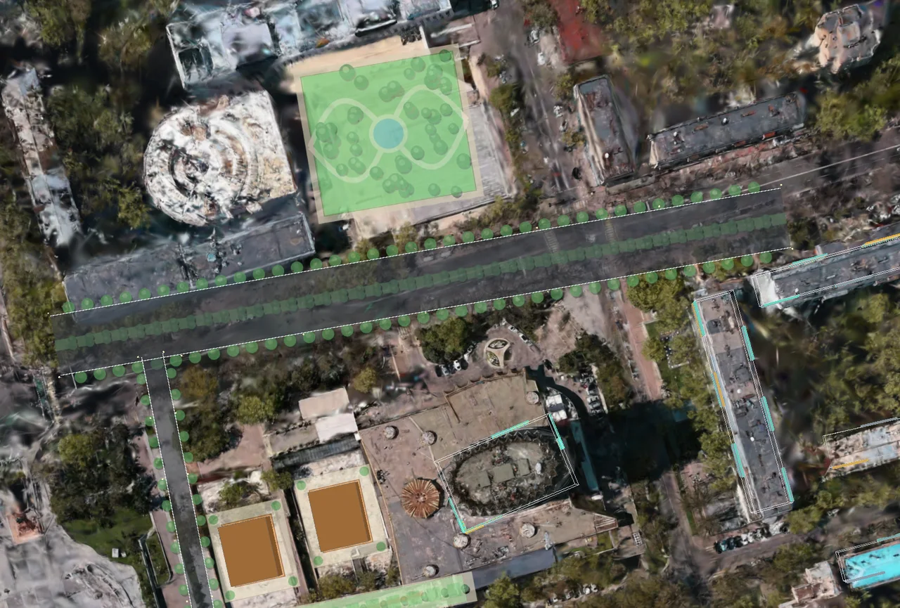
A reconstruction will happily agree with itself. The only way to find out whether it agrees with the world is to hold it against something it was not built from.
The reconstruction was checked against frames that were deliberately not used to build it, which is the only check that can catch a model that has confidently invented geometry.
The 3D is scaled from the building’s own published height rather than from anything the footage claims about itself.
Where a model was asked to read something off the scene, the answer was kept only where most frames agreed, and is marked as something for an engineer to confirm rather than a finding.
What the measurements are worth, stated plainly. Heights are scaled from the tower’s published height, and sources for that differ, so everything derived from it carries about fifteen per cent either way. That is normal for this kind of capture and it is enough to lay out homes, compare floors and judge a view. It is not a survey, it settles no boundary, and where a surveyed figure exists the surveyed figure wins.
This matters more than it sounds, because it is the difference between a few hundred pounds of work and a commissioned experience. Turning footage into a 3D is mostly unattended machine time. What takes a person is deciding what the thing should do.
Those are our own measured figures on our own hardware, across roughly sixteen hand-picked clips. They are a floor rather than a forecast: footage that arrives cold behaves worse. Of those sixteen, three failed outright and four needed an expert to rescue them, which is why we ask to see footage, or to advise before it is filmed, rather than quoting blind.
This was commissioned as a marketing demonstration rather than a survey, so it was built from stock drone footage of a real building. It is not a capture of the commissioning client’s own asset and does not represent one.
The building is real and the reconstruction is real. The homes, their availability, their owners, the prices and the surrounding plan are all samples, and the pictures of the future are illustrations rather than approved drawings. The building itself is not named.
The client who commissioned it is under non-disclosure and is not named, and nothing on this page is their property: not the building, not the plan, not a price. What was delivered to them was the demonstration itself, which is the thing being shown here.
The valuable part was never the renderer. It was the route from a drone flying for a few minutes to a buyer on a phone opening the exact home they are being sold. Tell us what you need people to understand and we will tell you honestly whether footage can carry it.